Three different websites using maps, three different stories.
A San Francisco walking tour company, a California statewide hospital and care facility rating service, and an international community of climate scientists. All these sites use Google Maps to engage and inform their visitors, and HyperArts customized each requirement!
Maybe you too would like to deploy maps on your site. For inspiration, here is what we did for these client sites.
Let’s start with the tour company.
Imagine you are a visitor to San Francisco and you would like to take a walking tour. You could click over to the San Francisco City Guides web site and find a tour on Find Your Tour: Find Tours Near Me. This page displays a map based on your location, the date, and the list of tours on that date. 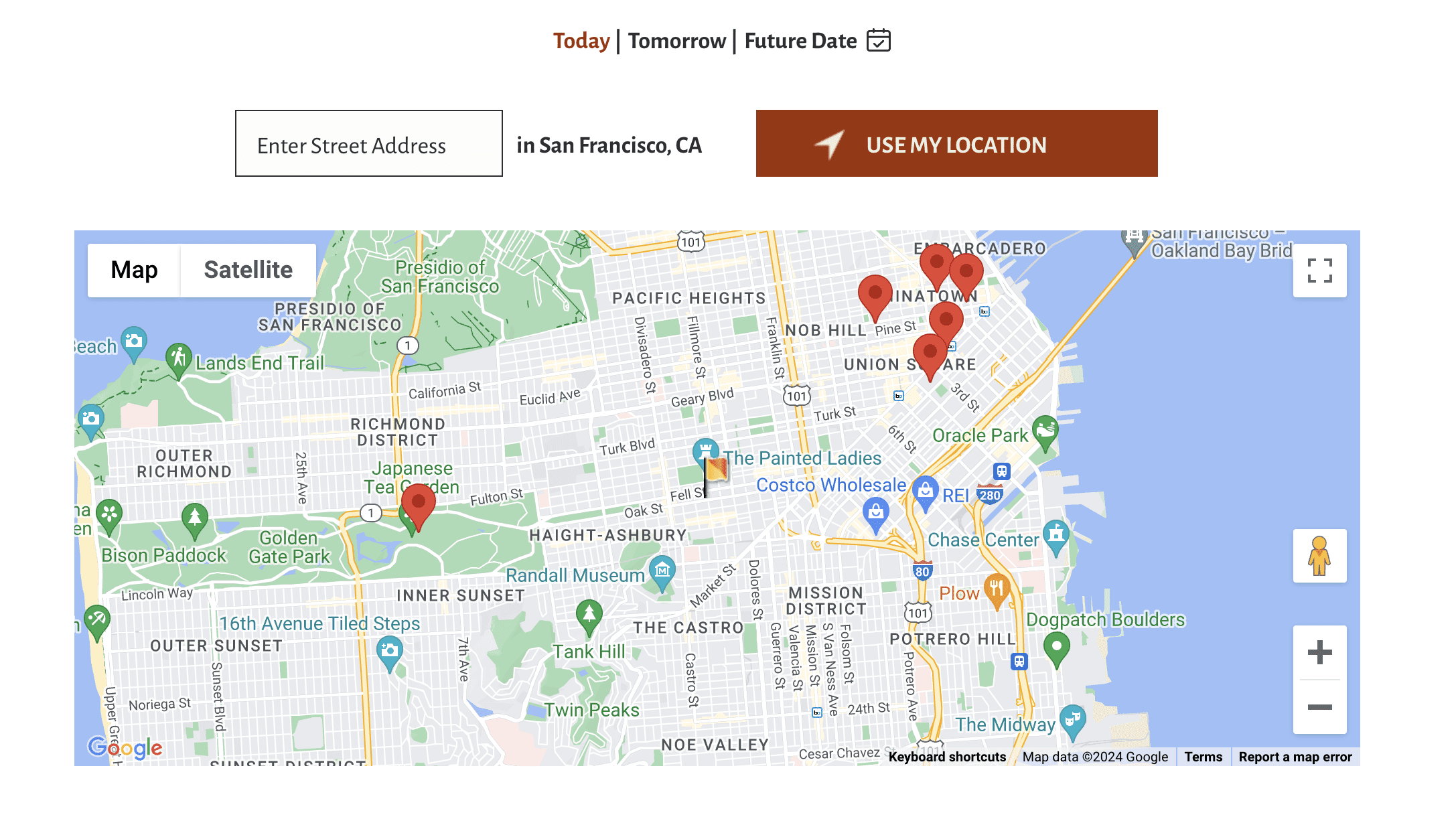
You can click from any pin and go to the description page for the tour. On that page, there’s a zoomed in map displaying the starting location for the tour! And if you reserve a spot on the tour, the map will be sent along with your confirmation. Helpful!
Now, let’s say you are thinking about health care, say, maternity care, or assisted living for yourself or a relative.
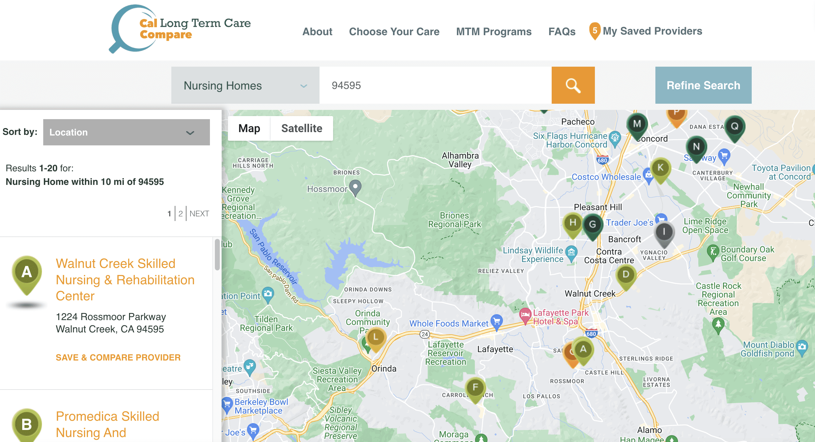
You want to find a well rated California long term care facility or a hospital, or check up on one you already know. The Cal Hospital Compare website and the Cal Longterm Care Compare website have you covered. When you search for facility ratings, because that’s what they provide, you can see a map of the area you are targeting with pins for the facilities in the area. When you click through to the facility rating page, you can see a small zoomed in map of the facility location. Helpful again!
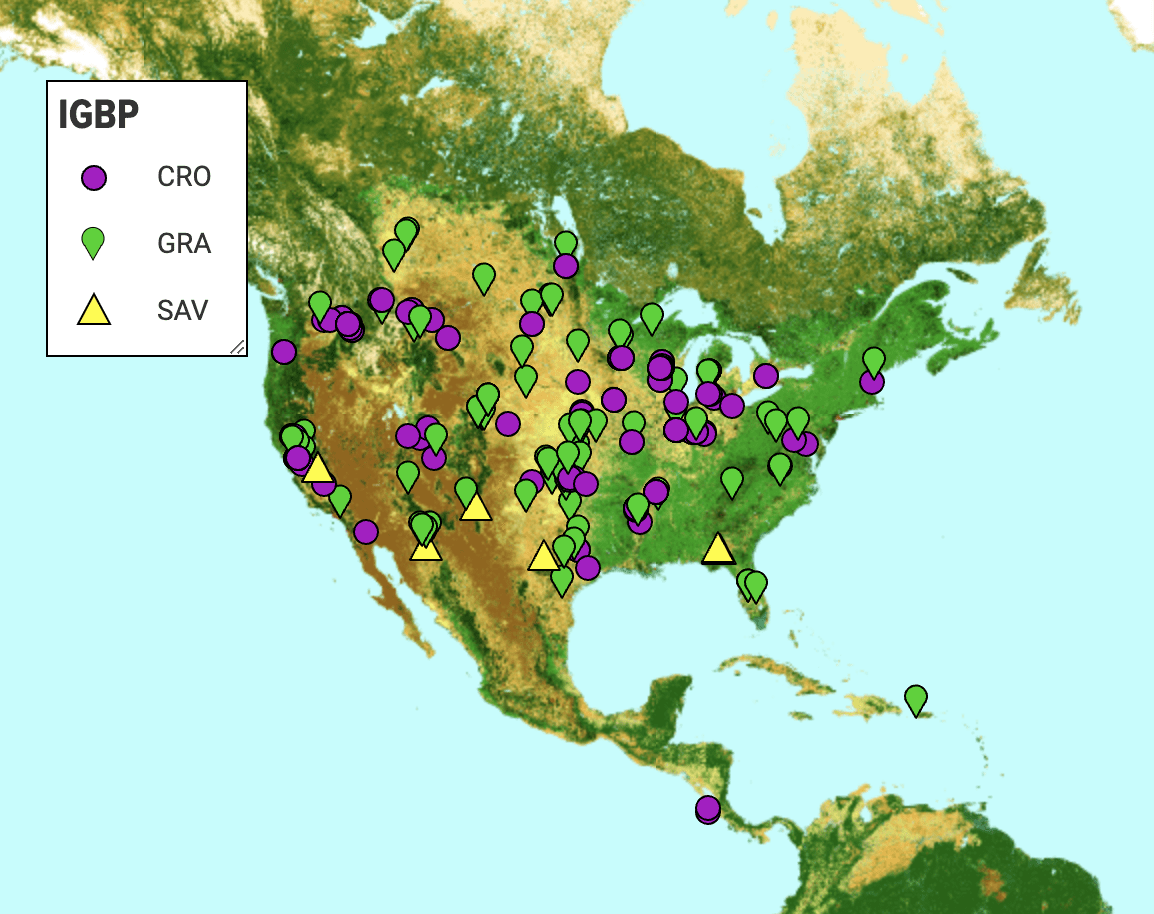
Finally, let’s say you have an interest in climate science and you have heard of the AmeriFlux project at the Lawrence Berkeley National Lab.
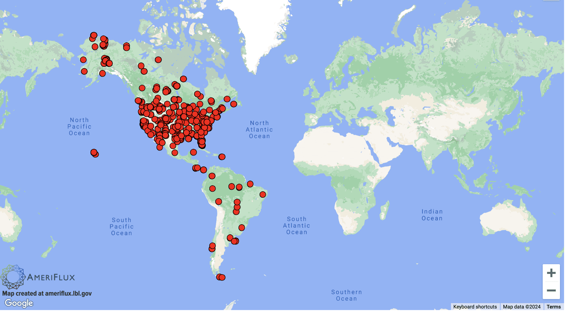
The AmeriFlux project collects data from sensors installed all over the Americas, from Canada to Argentina, in fields, forests, swamps and deserts. These sensors measure greenhouse gases like carbon and methane. (For a really precise scientific explanation, you should visit the website. And maybe get a PhD.) Let’s say though, that you want to find one of these sensors. There are a quite a few in the Sacramento delta! Or maybe you are in Oklahoma, or Mexico. When you use the Google Map on the site search page, you can see where the sensors are. You can even get driving directions for many sites. Could be helpful! Not all sites are near a road.
On the AmeriFlux site search map, more cool features besides directions are available for researchers to customize a map. A map can be assigned a title and the background of the map can be changed to indicate terrestrial features. Also, the pins on the map can be styled with colors and shapes you assign based on data characteristics. There’s an optional legend for those pins that you just colored and shaped. Pins have popup labels with info for each site. And, the maps are downloadable as pngs (doesn’t work on Safari).
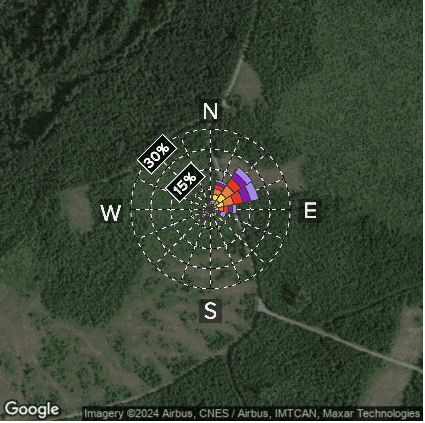
Another interesting use of Google Maps on the AmeriFlux site is the satellite image backgrounds that are used with a special graph called a windrose.